Street-Smart Assortments, One Block at a Time
Today we dive into hyperlocal product curation powered by neighborhood trend data, turning street-level signals into smarter assortments that feel personal, timely, and useful. Expect practical frameworks, honest stories, and field-tested tactics for translating block-by-block behaviors into baskets people actually love. Share your experiences, ask bold questions, and subscribe to follow ongoing experiments and case studies fueling this community-driven retail craft.
Mapping the Micro-Zones
Precision starts with boundaries that mirror how neighbors actually move, shop, and gather. Replace broad city segments with walk sheds, transit radii, and census block groups tied to lived routines. Layer schools, parks, nightlife, and senior centers to capture rhythms. Keep polygons humble, revisiting edges when construction, closures, or new bike lanes redirect flows, because a few meters often separate contrasting tastes, price sensitivities, and weekend rituals.
Sensing What Matters
Not every signal deserves equal weight. Footfall near beverage coolers, late-night search spikes for ramen, and event calendars each tell partial truths. Blend verified store transactions with privacy-safe social chatter, 311 reports, weather, and school schedules. Use decay functions so yesterday’s storm matters less than today’s sunshine, and calibrate source reliability, because a handful of loud posts can drown quiet but decisive spending shifts happening at checkout.
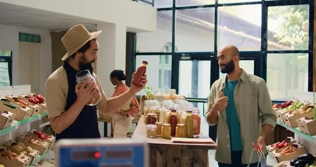
Translating Trends into SKUs
Turn messy inputs into a ranked buy list using interpretable scoring that connects demand lift, margin, pack sizes, and shelf realities. Add cannibalization penalties, attach supply risk, and respect cold chain or halal constraints. Visualize trade-offs so merchants see why two premium salsas overlap, and compute small batch tests. Celebrate quick wins, retire duds compassionately, and roll learning forward through concise playbooks everyone can trust and improve.
Data with a Human Accent
Numbers hint at direction, but people give reasons. Blend analytics with shopkeeper observations, local historians’ context, and conversations overheard near bus stops. The most resonant choices acknowledge identity, migration, and memories tied to tastes. A late-summer surge for mango pops can reflect reunions, heat, and music festivals at the park. Invite residents to co-create assortments, rewarding suggestions that spark delight without inflating prices or excluding quieter preferences.
Models That Respect the Neighborhood
Great models acknowledge sparse data, sudden shifts, and cultural nuance. Instead of overfitting to noisy posts, build systems that borrow strength across similar blocks while keeping space for authentic differences. Mix time series with event features, learn seasonal pulses, and detect regime breaks. Equip merchants with sliders for exploration appetite. Share learnings openly so others replicate wins, avoid repeats of mistakes, and build confidence grounded in visible, consistent improvement.
Measuring What Matters
Assortment success is not just revenue; it is satisfaction, discovery, and resilience under surprises. Track sell-through, stockouts, days of supply, and freshness, but also survey delight, community recommendations, and returns. Compare before-and-after baskets for new items and monitor affordability across pay cycles. Invite readers to share metric frameworks that influenced executive buy-in, and subscribe to receive open templates, dashboards, and annotated case studies you can adapt within your neighborhood context.
Assortment Quality Score
Create a transparent composite that balances margin, novelty, repeat purchase, sustainability, and customer-reported joy. Penalize fragile items that travel poorly to small shops, and reward locally sourced goods with community endorsements. Make weights visible, adjustable, and governed by cross-functional stewards. Publish monthly scorecards, celebrate merchants who improve customer experience without overspending, and invite readers to propose additional sub-metrics that align with dignified, inclusive, and environmentally responsible neighborhood commerce.
Basket Stories and Affinity
Use market-basket analysis to identify pairings that tell stories, like cold brew with oat milk after city bike rides, or spicy noodles with sparkling water during exam weeks. Surface inspiring bundles and endcap notes that nudge exploration. Track lift and halo effects, refining placements quickly. Invite comments about your most surprising pairing discoveries, and publish a quarterly gallery of regional combinations that delighted shoppers while keeping budgets friendly and shelves tidy.
Equity and Inclusion Metrics
Fair curation ensures dietary needs, cultural traditions, and mobility limits are respected. Measure representation of halal, kosher, gluten-free, vegan, and heritage flavors balanced with affordability. Survey perceived welcome across languages and accessibility. Watch who benefits from promotions and who is left behind. Share corrective actions transparently, and build a public pledge for equitable assortment that other neighborhoods can adapt, critique, and steadily strengthen with real, measured accountability over time.


Operations at Street Speed
Hyperlocal choices strain operations unless supply, storage, and staff adapt quickly. Design nimble replenishment with safety stock tuned to event calendars and weather swings. Use micro-fulfillment or pooled buying across nearby shops to handle minimums without overstock. Standardize lightweight tests so swapping two facings takes minutes, not weeks. Encourage comments about scrappy hacks that made speed possible, and subscribe for checklists that turn clever improvisations into reliable practice.

Privacy, Safety, and Trust
Neighborhood insights must never compromise dignity. Commit to data minimization, strong safeguards, and clear explanations that earn confidence. Prefer aggregated, consented sources over invasive tracking, and rotate audits with external partners. Communicate changes to shoppers and merchants in plain language, offering controls without friction. Share cautionary tales and fixes, building a culture where protecting people is celebrated as a competitive advantage and moral baseline, not an afterthought demanded by regulators.